Remote sensing

Results: 12649


#Item
891This article was downloaded by: [Montana State University Bozeman] On: 16 February 2012, At: 08:47 Publisher: Taylor & Francis Informa Ltd Registered in England and Wales Registered Number: Registered office: Mor

This article was downloaded by: [Montana State University Bozeman] On: 16 February 2012, At: 08:47 Publisher: Taylor & Francis Informa Ltd Registered in England and Wales Registered Number: Registered office: Mor

Add to Reading List

Source URL: remotesensing.montana.edu

Language: English - Date: 2015-02-27 15:20:39
892Evaluating remote sensing data impacts from the bottom up – A USGS example JACIE 2016, Fort Worth, TX

Evaluating remote sensing data impacts from the bottom up – A USGS example JACIE 2016, Fort Worth, TX

Add to Reading List

Source URL: calval.cr.usgs.gov

Language: English - Date: 2016-05-03 10:00:31
893Citation: Wang, H., & Ellis, E.CImage misregistration error in change measurements. Photogrammetric Engineering & Remote Sensing, 71, The work from which this copy is made includes this notice: Copyri

Citation: Wang, H., & Ellis, E.CImage misregistration error in change measurements. Photogrammetric Engineering & Remote Sensing, 71, The work from which this copy is made includes this notice: Copyri

Add to Reading List

Source URL: ecotope.org

Language: English - Date: 2014-05-17 15:32:15
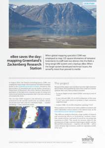
894CASE STUDY  eBee saves the day: mapping Greenland’s Zackenberg Research Station

CASE STUDY eBee saves the day: mapping Greenland’s Zackenberg Research Station

Add to Reading List

Source URL: www.sensefly.com

Language: English - Date: 2015-07-09 04:32:32
895Microsoft Word - COMET_InSAR_Processor_ISPRS16_Submission.docx

Microsoft Word - COMET_InSAR_Processor_ISPRS16_Submission.docx

Add to Reading List

Source URL: www.int-arch-photogramm-remote-sens-spatial-inf-sci.net

Language: English - Date: 2016-06-14 07:40:08
896A PROPOSED BASE FOR GEOGRAPHIC INFORMATION SYSTEM FOR INDIA Prithvish Nag National Atlas and Thematic flapping Organisation BOA Gariahat Road, Calcutta, India. ABSTRACT Attempts have been made by different organi

A PROPOSED BASE FOR GEOGRAPHIC INFORMATION SYSTEM FOR INDIA Prithvish Nag National Atlas and Thematic flapping Organisation BOA Gariahat Road, Calcutta, India. ABSTRACT Attempts have been made by different organi

Add to Reading List

Source URL: mapcontext.com

Language: English - Date: 2008-08-30 01:18:06
897NRL BAA Announcement # LOW FREQUENCY RADIO INTERFEROMETRY The Remote Sensing Division of the Naval Research Laboratory is developing and deploying imaging HF/VHF radio interferometer for use in developing, demon

NRL BAA Announcement # LOW FREQUENCY RADIO INTERFEROMETRY The Remote Sensing Division of the Naval Research Laboratory is developing and deploying imaging HF/VHF radio interferometer for use in developing, demon

Add to Reading List

Source URL: heron.nrl.navy.mil

Language: English - Date: 2016-02-17 10:17:53
898THE AUGMENTED SCENE: INTEGRATING THE MAP AND THE ENVIRONMENT James E. Mower Department of Geography and Planning and Geographic Information System and Remote Sensing Laboratory University at Albany, State University of N

THE AUGMENTED SCENE: INTEGRATING THE MAP AND THE ENVIRONMENT James E. Mower Department of Geography and Planning and Geographic Information System and Remote Sensing Laboratory University at Albany, State University of N

Add to Reading List

Source URL: mapcontext.com

Language: English - Date: 2008-08-29 22:38:06
899Microsoft Word - 12_FullPaper.doc

Microsoft Word - 12_FullPaper.doc

Add to Reading List

Source URL: ubimap.csis.u-tokyo.ac.jp

Language: English - Date: 2016-04-20 09:45:36
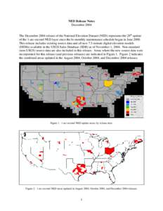
900Microsoft Word - NED_Release_Notes_Dec04.doc

Microsoft Word - NED_Release_Notes_Dec04.doc

Add to Reading List

Source URL: nationalmap.gov

Language: English - Date: 2013-10-22 12:06:54